I know, this is a VFR navigation tool.
However.. it would be nice to be able to see and select the IFR waypoints, too.
I can, of course, define them as custom waypoints. This takes a lot of time - unless there were a bulk import tool.
These points are useful also for VFR pilots, when filing a flight plan. They make life for everyone involved a lot easier. So it would be nice to have them in the database right away.
→ Yes, I understand and support your request. From my own experience, I know that, especially in the Baltic states, their waypoints in the flight plan are a good choice. 2. VFRnav is for VFR pilots. Hermann needs to devote his energy to development, maintenance, and support. …I quickly added the IFR waypoints for such flights myself. This way, you learn for the flight right away.
Ah … Latvia
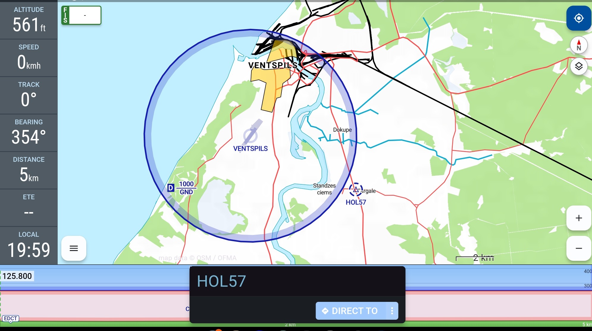
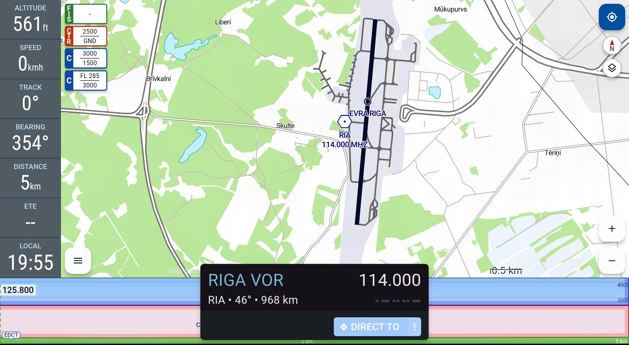
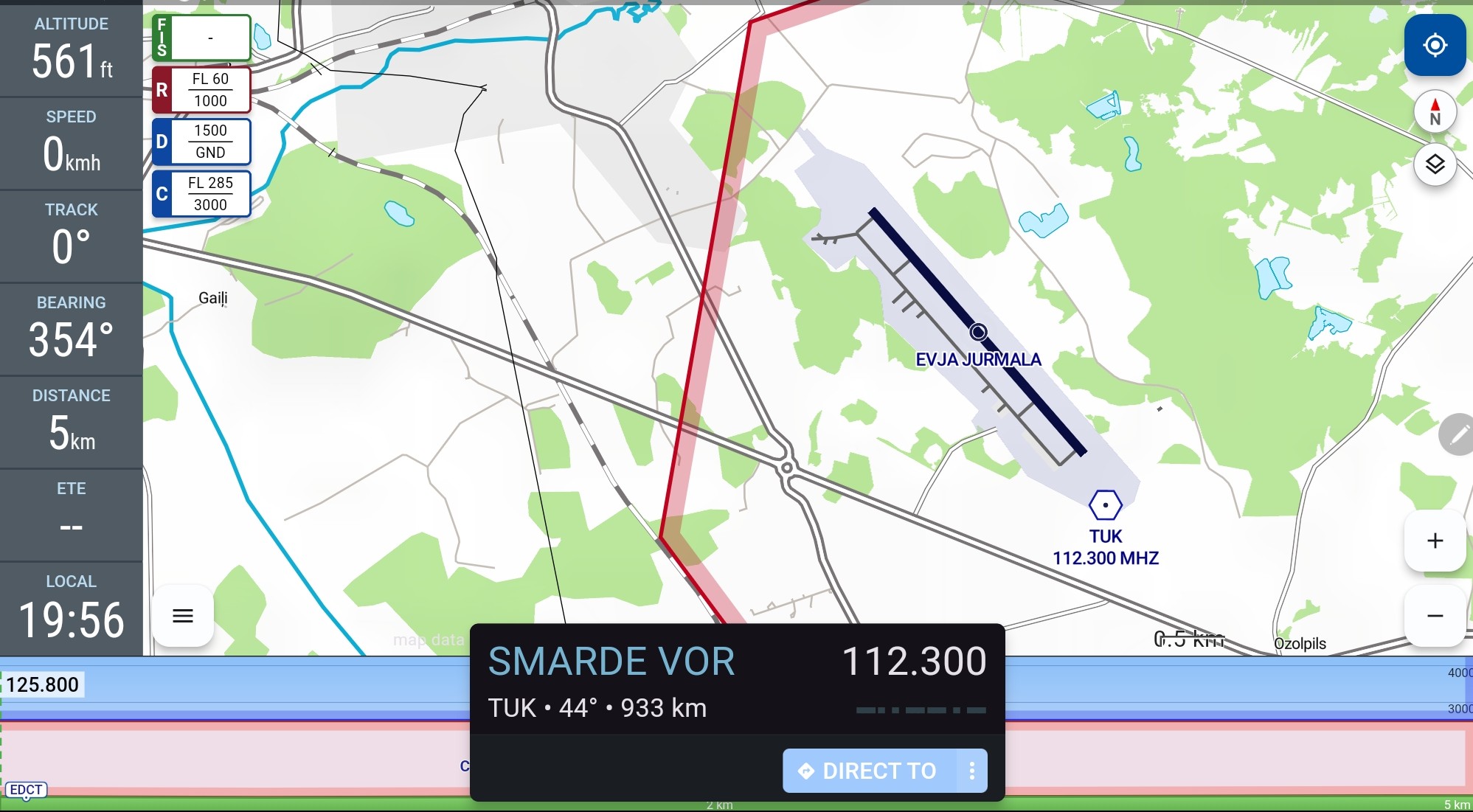
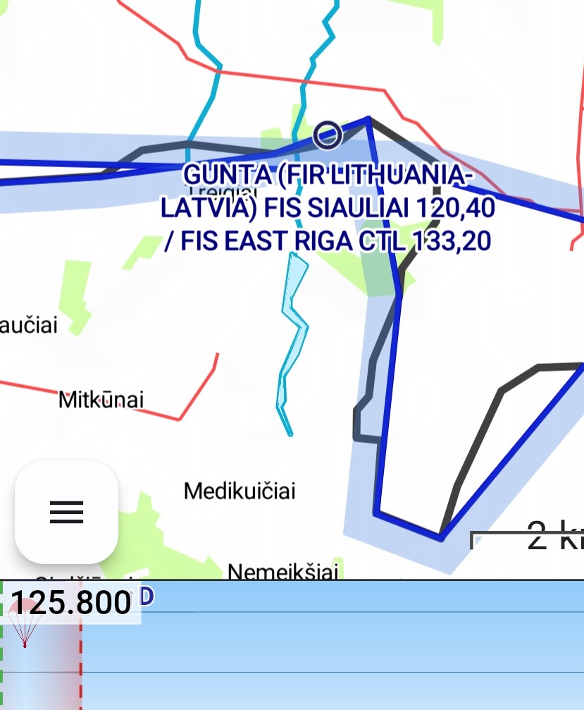
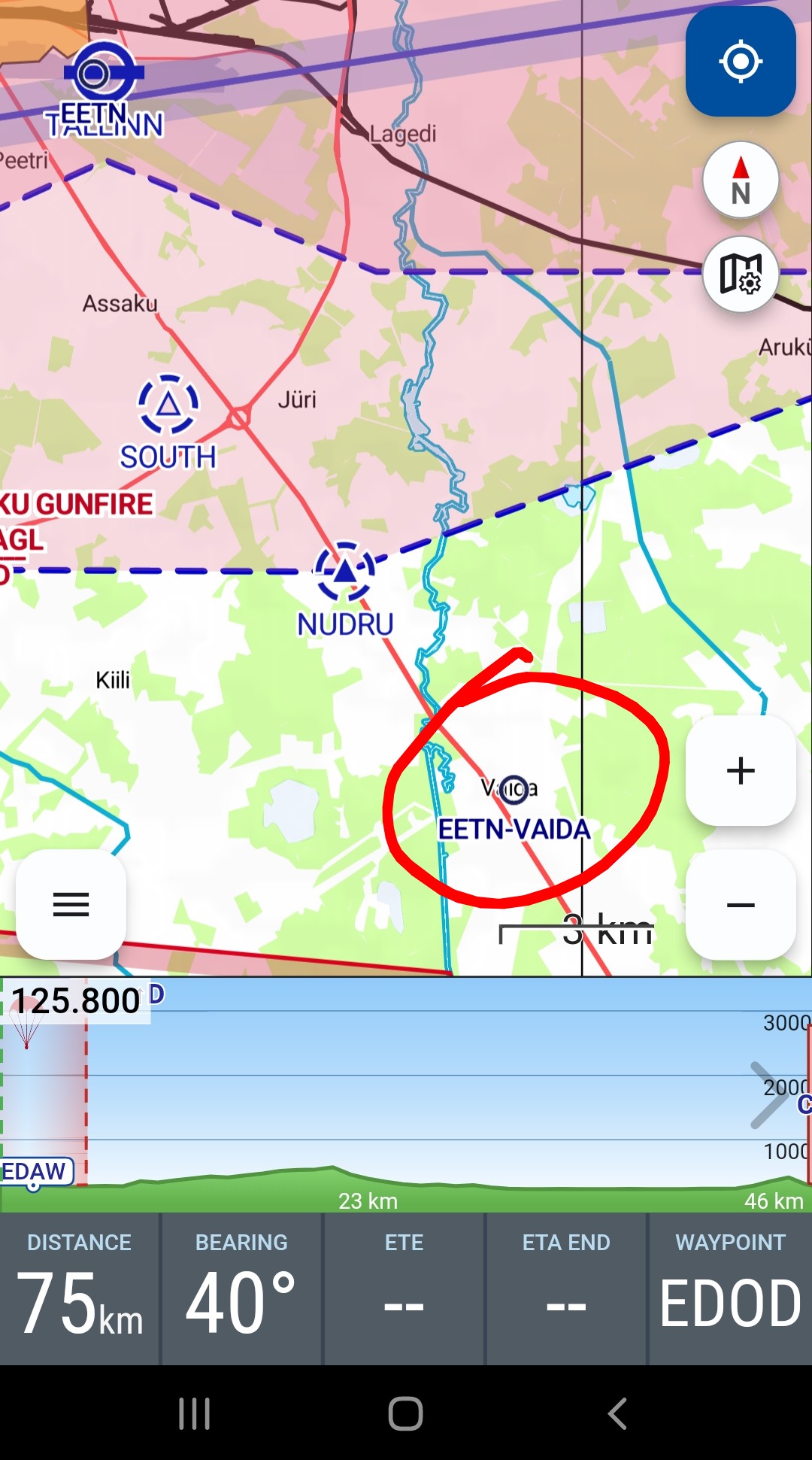
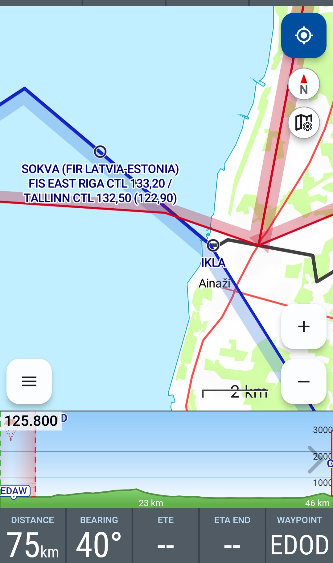
I remember a tour through the Baltics. Through Poland, Lithuania, Latvia, and Estonia. We ended up in Adazi. …I took a look. …Maybe the NavAids aren’t complete? …But I can find some on the map. Take a look…
Vorrei riproporre il thread e la richiesta. L’integrazione e (anche opzionale) la visualizzazione dei waypoint a cinque lettere sarebbero davvero utili, non da ultimo per la compilazione del piano di volo e per il volo in alcuni paesi europei. Cordiali saluti!
Per l’integrazione è necessaria una fonte aggiornata e affidabile ( database con accesso).
Condivido il tuo desiderio e anche quello del collega!
Ricordo ancora il mio tour attraverso il Baltico. Allora non esisteva l’offerta cartografica di oggi. All’epoca, con il supporto di Hermann, abbiamo costruito le carte da soli e integrato informazioni essenziali. Poiché per i rispettivi piani di volo erano effettivamente necessari punti IFR, tra l’altro.
Allego volentieri 3 esempi.
Questa sarebbe almeno una possibilità che offre VFRnav. Ampliare la libreria di simboli ( z.B. per i punti di riporto obbligatori) è nella lista delle cose da fare.
Naturalmente non è una soluzione finale. Ma arriverà.
In effetti troverei molto utili anche i punti IFR (spazio aereo inferiore en-route), con l’NVFR (VFR notturno) li uso molto spesso e dunque si potrebbero rendere attivabili e disattivabili, eventualmente anche insieme a una visualizzazione notturna.