Hello everyone,
I have been flying enthusiastically with VFRnav for several years.
Lately, I keep encountering aircraft that I only notice quite late. I have to do something about that.
Since I
Hello Thomas,
According to the specifications shown on the page you linked, the Flex supports the GDL90 protocol over Wi-Fi as well as Bluetooth LE and is therefore fully compatible with VFRnav.
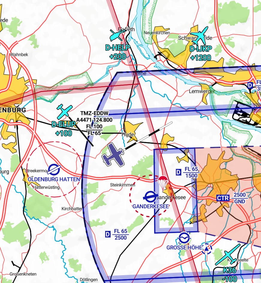
The received traffic data is displayed directly on the map – similar to the image below.
The warning is currently being revised so that it harmonises with the airspace warning. It will then also include an audible alert if VFRnav is connected to the headset via Bluetooth.
Let me know if you have any further questions.
Happy flying
Hermann
Hello Hermann
Looks good
Does +200 mean 200m or ft above me?
Regards
Thomas
Correct ![]()
Ft or m?
That’s a difference
Or is that set in the general settings of vfrnav?
Sorry, I read your “or” as “respectively”.
The display of relative altitude depends on the altitude unit set for the aircraft.
So if the “Altitude” widget is set to metres, the rel. altitude is also in metres. Otherwise feet.
Happy flying
Hermann