Is it possible to set a preference for at which zoom level certain symbols should be visible?
Things like reporting points or VORs are useful to see at a high zoom level.
That way you can find them more easily.
Best, Daniel
Is it possible to set a preference for at which zoom level certain symbols should be visible?
Things like reporting points or VORs are useful to see at a high zoom level.
That way you can find them more easily.
Best, Daniel
Hi Daniel,
The mandatory reporting points, e.g. for CTR (control zone), only appear starting at Zoo level 6 ( 5x +) , right? …the approach routes from level 6 …? …and you want to be able to set that flexibly?
Happy flying,
Karsten
Hi Karsten,
the waypoints only appear at the 1 nm zoom level.
Which is pretty annoying for spontaneous changes or just in general.
Practical example:
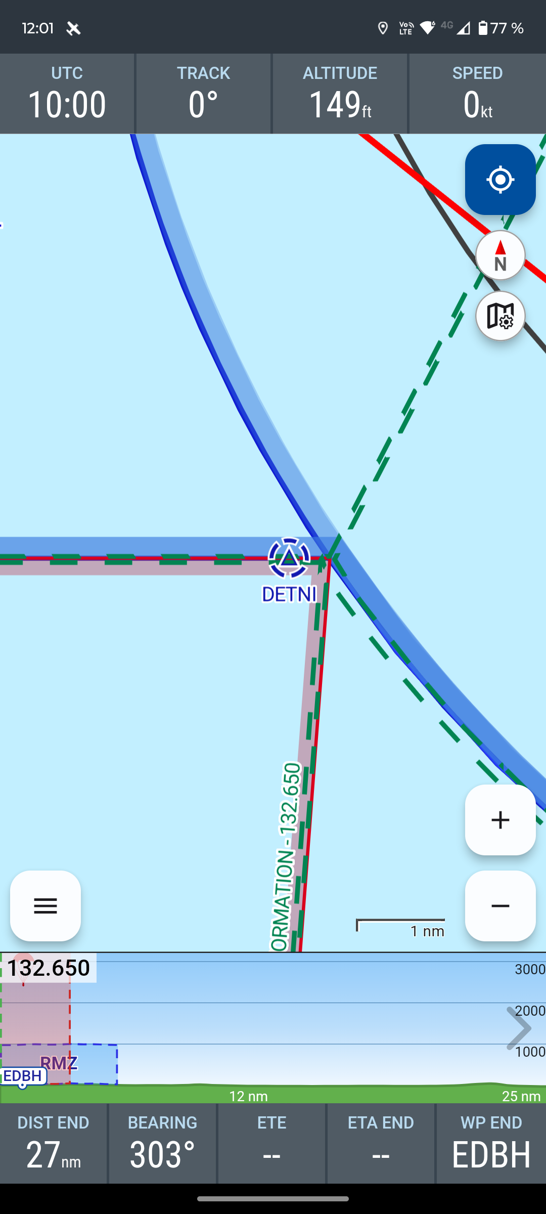
We taxied out at EKRN with a flight plan, planning to depart via DETNI.
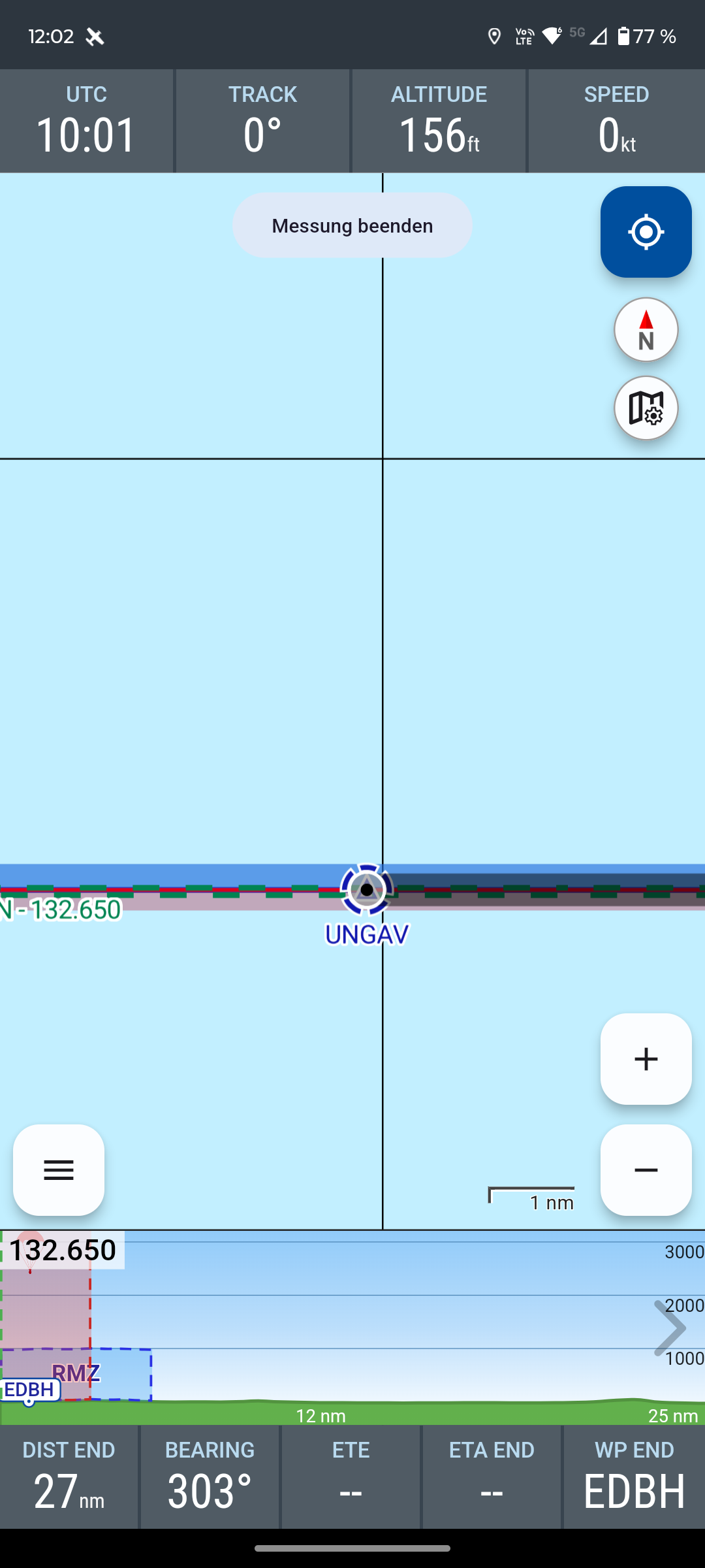
As we were rolling onto the runway we were suddenly given UNGAV instead of DETNI.
Finding the waypoint between radio calls, checklists and the takeoff roll wasn’t easy ![]()
Especially not for me, since it was my first time taking off from EKRN.
If you could see the waypoints at a different zoom level, you could quickly zoom out, adjust the route and zoom back in.
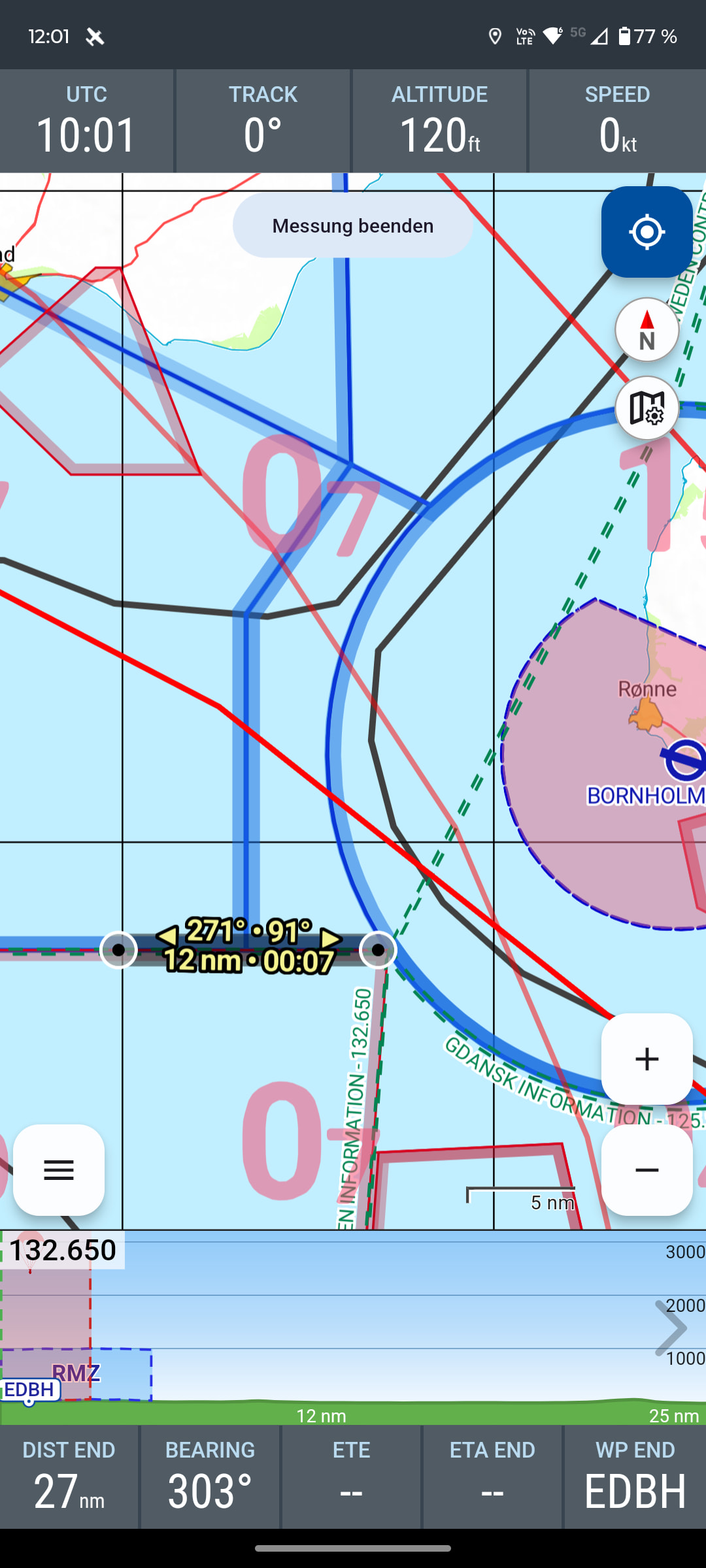
The same applies to VORs.
They would be easier to find and navigate to if they were visible at a more zoomed-out level, e.g. 10 nm.
Cheers, Daniel
Hello Daniel,
Thanks for your valuable practical account![]() . Primarily, it’s about not overloading the map at small zoom level(s) with too much information. That can quickly become confusing. → Nevertheless, I absolutely understand your arguments and wish.
. Primarily, it’s about not overloading the map at small zoom level(s) with too much information. That can quickly become confusing. → Nevertheless, I absolutely understand your arguments and wish.
If necessary, a Direct to UNGAV would have been possible (…which would, of course, only have been an emergency solution.)
…I’m just thinking… How about if you tap the planned RP DETNI? Currently the red trash can appears there. …here it might be possible to also show selection points for resting in the area within xxx miles. …if you then select a point, it will be incorporated into the routing.
Let’s see what @H655 says about that![]() ?
?
PS: yes, Bornholm is still a blank spot for me too… If only there weren’t so much water![]()
→ and please write a short report about Bornholm in VFRnav. Thank you ![]()
Thanks for the interesting contribution!
Happy flying,
Karsten
Rerouting itself works.
Either via the trash bin or in the route planner.
It would be easier if you could just drag the route.
However, the waypoints (WPs) are so far apart that you can’t do that. ![]()
That brings us back to the zoom issue.
Cheers, Daniel
Good morning,
I think this could fit quite well with our planned restructuring of the map-point dialog (double-tapping the map). In the “Waypoints” tab the “visibility range” of nearby waypoints should therefore be increased. That would make such points easier to find, wouldn’t it?!
Second idea:
In flight, for each waypoint we currently essentially have the options to append the point to the end of the route or to use it as a Direct-To.
Additionally, an option like “Insert waypoint” might make sense here. That would allow you to deliberately extend the existing route with an additional waypoint or to reroute en route via a new point. ![]()
Pilot’s regards
Hermann
Sounds good to me ![]()
Best, Daniel