Taxiway designations

Hello everyone,

I’m a newly qualified pilot and I’m currently testing various apps.

The VFRnav app is always in focus. A very nice, smooth app that isn’t cluttered.

One question:

Is it planned to display the taxiway names as well?

Kind regards

Daniel

Hello Daniel,

You’re probably referring to the default AD chart when you zoom in to the maximum?
This view is only intended as a rough overview. The authoritative versions are the AD (Ground) charts for aerodromes published in the eAIPs of each country. These have been freely available for all European countries I know of and, for some time now, finally also for Germany.
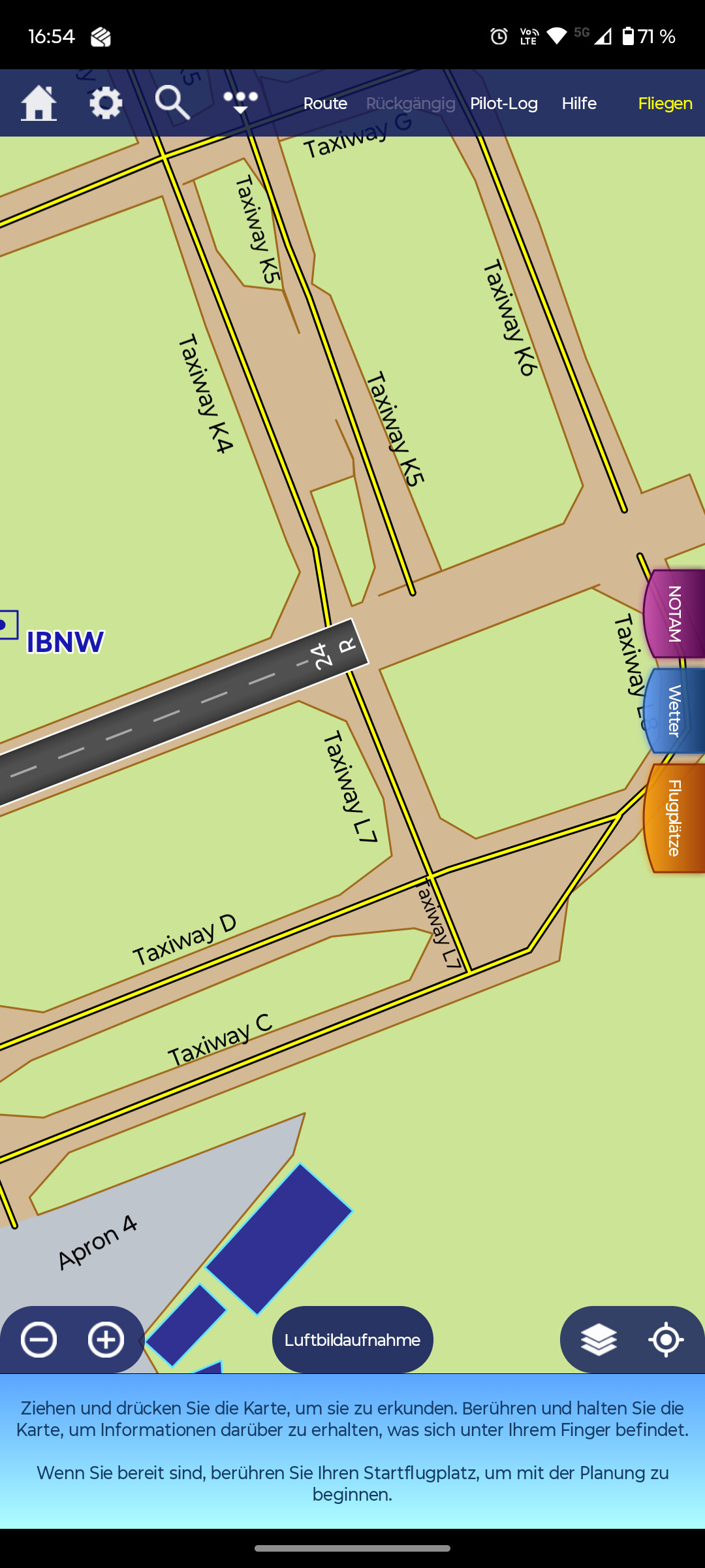
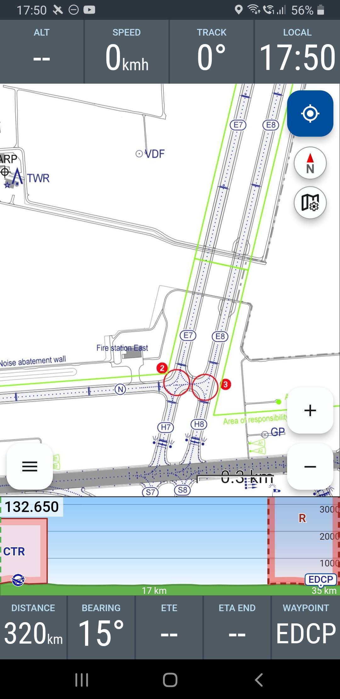
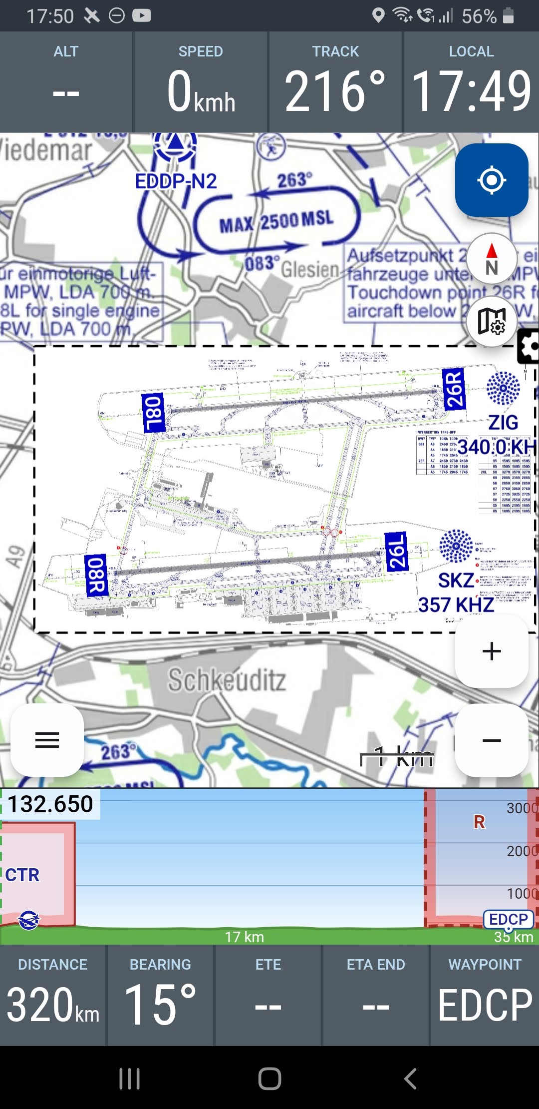
An automatic georeferencing of these (initially for Germany) is, as far as I know, on the to-do list. You can always do it yourself – though not super accurately, since the reference points only cover a small distance. It works well for larger airports, but not so much for smaller ones. Perhaps you’re familiar with the related page?

Otherwise, you can always access the ground chart via the AIP tab.

Clear skies,

Karsten

Exactly. I meant that if you zoom in closely, you can see the designations, as you can here in SkyDemon.

In the end I use the data from the AIP anyway; it’s official.

I can’t very well tell the tower in Berlin, ‘but my app says it’s Taxiway A’ :joy:

It’s just an additional aid. If it’s planned for the future, great.

Kind regards,
Daniel

Hello Daniel,

I don’t want to pre-empt Hermann. Of course, we’re talking about VFRnav here, not Skydemon. Whether anything will change in the base display regarding identifiers is something Hermann will have to answer – I think the effort isn’t justified, since the AIPs exist. …and there’s certainly something possible here.

Here’s an example which I calibrated myself as described and integrated into VFRnav with 2 layers. For my quasi Fast Homebase Leipzig LEJ.

..and you can already do that yourself now. One of many brilliant advantages of VFRnav.

Pilot greetings,
Karsten

1 Like

I’ll take a look at that in detail.

That should be enough.

:wink::+1:…and at this point (if not already known) a pointer to Hermann’s VFRnav YouTube channel. It explains many things briefly and concisely.

1 Like

Hello Daniel,

A warm welcome and many thanks for your contribution.

The option to display detailed ground charts of larger airfields is already on the to-do list—either directly as chart data or via the AIP charts.

At the moment, however, this is not available and the only option is manual integration, as described by Karsten.

Aviator’s greetings

Hermann

1 Like