 VFRnav 4.30
We’re incredibly proud to present VFRnav 4.30!
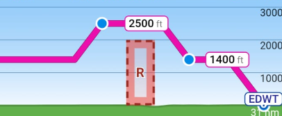
One of the features you’ve requested most frequently is finally here: the planned route can now be displayed directly in the vertical airspace profile!
This means that your planned altitude now becomes an integral part of the vertical profile, making it much easier to evaluate your route in relation to terrain and airspace. Prefer the classic view? No problem — the route display in the vertical profile can be disabled in the settings.
Flight Planning & Weight & Balance
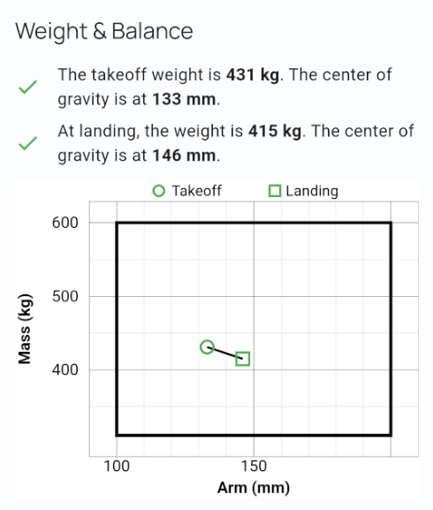
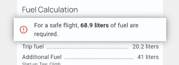
The route calculation has also received several improvements. Important limits regarding fuel reserves and Weight & Balance are now immediately visible, giving you a quicker overview of whether your flight remains within the configured limits.
In the aircraft profile, you can now enable separate Weight & Balance calculations for takeoff and landing. This makes it possible to correctly account for changes in aircraft mass and center of gravity caused by fuel consumption during the flight.
A Modernized PIB
The PIB (Pre-Flight Information Bulletin) has received a major visual overhaul. The printed version is now significantly clearer and easier to read.
In addition, A5 is now the default print format, making the PIB a better fit for commonly used pilot kneeboards.
HSI for Tablets
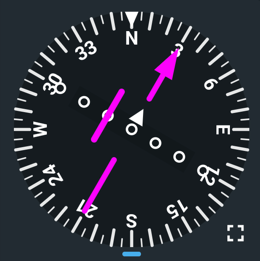
Another new addition is the HSI (Horizontal Situation Indicator), which is now available on tablets. It can be disabled in the settings if you prefer the previous layout.
And for users of smaller devices: a corresponding CDI display is planned for one of the upcoming updates.
Further Changes
-
Completely redesigned saved-route management: Saved routes can now be assigned labels, making it much easier to organize and filter a larger collection of routes.
-
Long pilot reports and airfield experiences are now shown in a shortened form for better readability and can be expanded with a single tap.
Bug Fixes
-
Fix: External map storage can now always be reset to internal storage, even if copying the map data fails.
-
Fix: Long checklist entries are now displayed correctly instead of being truncated.
Many of the improvements in this release are based directly on your feedback and suggestions. Thank you for helping us make VFRnav better!
As always, if you encounter any issues or have ideas for further improvements, we’d love to hear from you — send us an email or join the discussion here in the forum.
Blue skies and safe flying! 
– Your VFRnav Team
 The overview of saved routes is vastly improved. I really like it.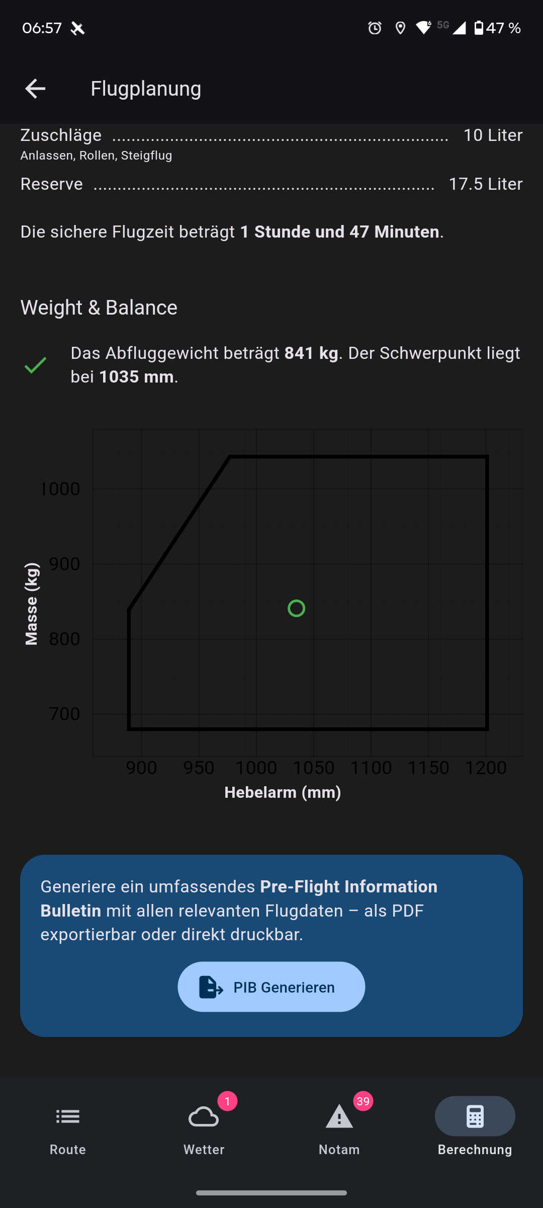


 Will be fixed in the next update.